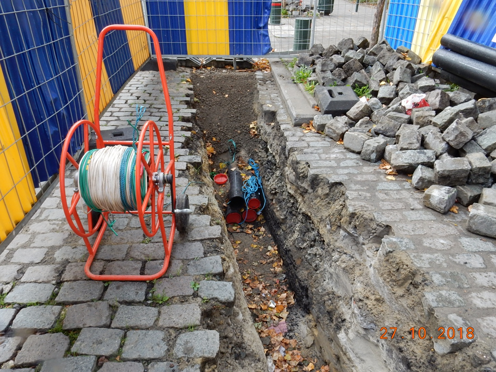
Underground Utility Mapping Survey
To address the challenges posed by poorly managed underground utilities, we offer Underground Utility Mapping Surveys. This essential service helps prevent disruptions to water and electricity supplies and mitigates risks of accidents, such as gas explosions. Our approach utilises electromagnetic wave signals to accurately detect the alignment and depth of underground utilities, providing clients with vital information for:
- Detecting utility alignment and depth
- Managing utility properties using record drawings
- Designing utility layouts
- Reducing project risks and costs associated with utility damage
- Complying with statutory regulations, such as the Electricity Supply Lines (Protection) Regulation Cap 406
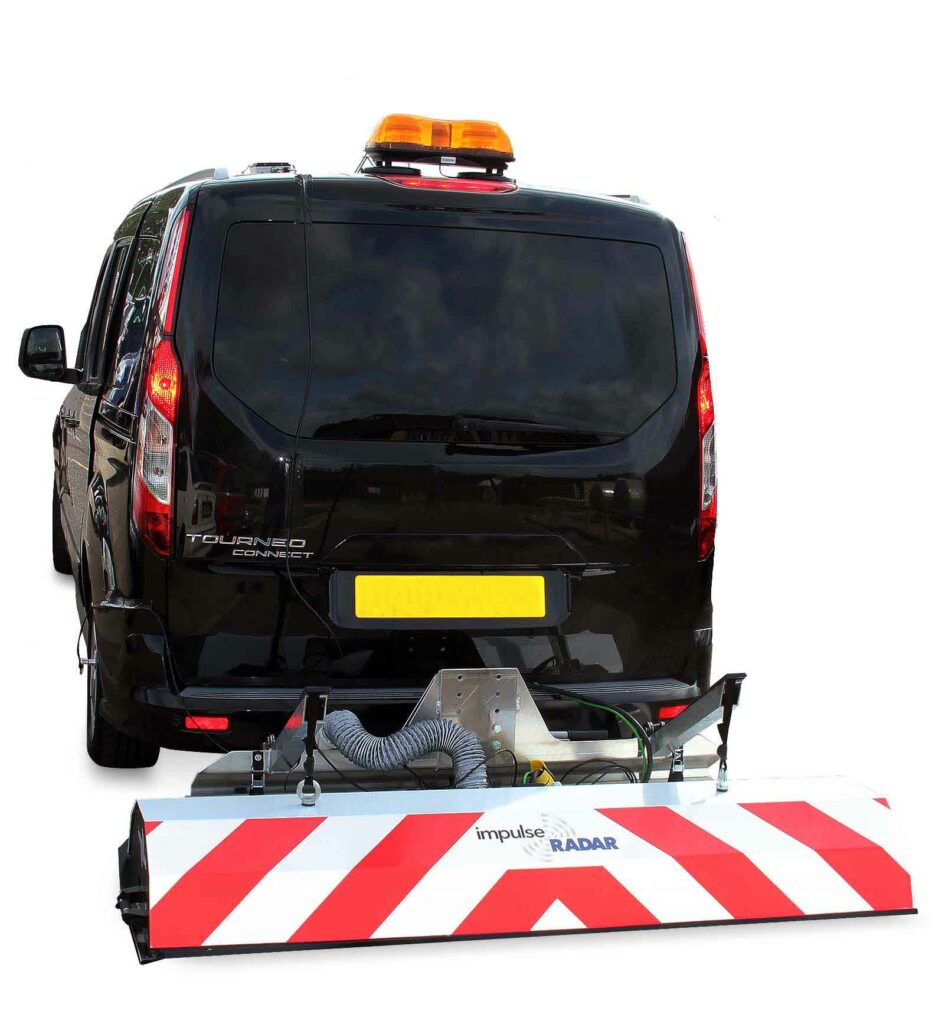
Multi-array Vehicle Mount 3D GPR Survey
This Multi-array Vehicle Mount 3D GPR System consists of several individual antenna elements (transmitters and receivers) arranged to create multiple measurement channels that operate simultaneously and are closely spaced. It is designed to survey larger areas and apply 3D processing and visualisation techniques, collecting significantly more data in one pass compared to a typical GPR system. Furthermore, this vehicle-mounted system can help eliminate the need for Temporary Traffic Arrangements in carriageway areas, greatly reducing the time and cost of survey work.
- Application:
- Underground Void Detection
- Road Health Condition Survey
- Water Leakage Detection
- Archaeological Investigations
- Utility Mapping
- High-speed carriageway application
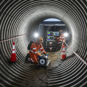
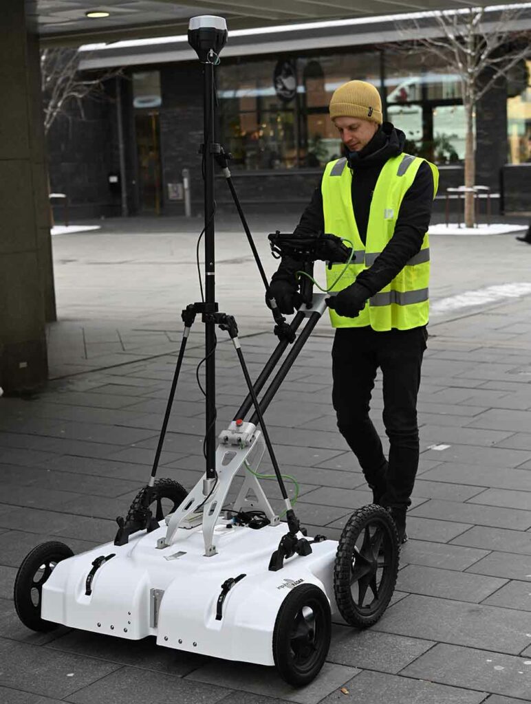
Gyroscopic Survey
Gyroscopic Utility Mapping is an advanced technology for locating and mapping underground utilities with high precision. It uses gyroscopic sensors to detect and map pipelines, cables, and other buried infrastructure without the need for excavation or disruption. Underground utility mapping prevents accidents, reduces construction delays, and ensures the safety of workers and the public
Gyroscopic Utility Mapping provides a fast, precise, and non‑destructive method for locating underground utilities without the need for excavation. It delivers highly accurate results even in dense urban environments like Hong Kong, helping prevent costly delays, repairs, and utility strikes. This technology is ideal for complex settings— such as tunnels, high‑rise districts, and narrow streets—offering reliable mapping that enhances project efficiency, reduces risks, and improves overall safety for workers and the public.
Gyroscopic Utility Mapping is widely used across construction and infrastructure projects to accurately locate underground utilities before excavation, helping prevent costly damage and delays. It supports urban development by providing precise data for planning new infrastructure, and is essential for safe road, railway, and tunnel projects in the transportation sector. The technology also benefits telecommunications and utility providers by enabling efficient detection, maintenance, and management of underground cables and pipelines for water, gas, and electricity.
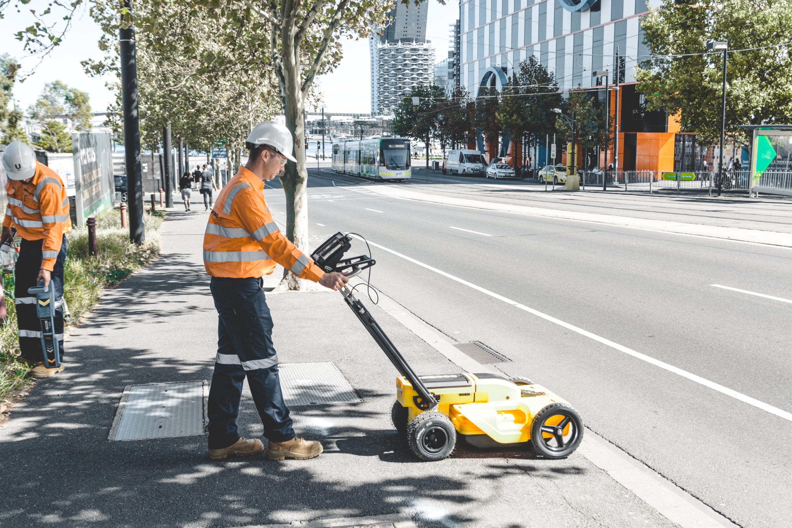
Electromagnetic Survey – PCL
Electromagnetic Survey – PCL is a non‑intrusive subsurface mapping service used to detect and locate buried utilities, metallic objects, and conductivity variations in the ground. Using portable EM induction sensors, this method quickly collects data across large areas and identifies changes in soil conductivity that indicate the presence of underground infrastructure or anomalies. It is an efficient, fast, and reliable tool for utility detection, site assessment, and project planning.
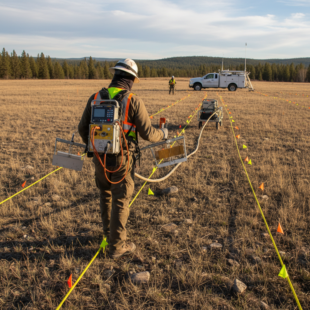
Electromagnetic Survey – PCL offers a fast, non‑intrusive method for detecting buried utilities, metallic objects, and subsurface conductivity changes across large areas. This technique improves on‑site safety, reduces excavation risks, and provides reliable data to support planning, design, and construction decisions. With applications ranging from utility mapping and environmental assessments to locating buried tanks, drums, and infrastructure assets, EM surveying is an efficient and versatile solution for a wide range of project needs.